Northwest faces freezing rain/heavy snow - Arctic blast loosens grip on eastern US
1/17/2024, 7:44 a.m.

Originally Published: 17 JAN 24 03:35 ET
Updated: 17 JAN 24 08:34 ET
By Elizabeth Wolfe and Robert Shackelford, CNN
(CNN) — As a brutal Arctic blast wraps up in the eastern US, a new winter storm system is bringing freezing rain and precarious road conditions to the Pacific Northwest. Here’s the latest.
• Freezing rain knocks out power: Freezing rain and wind pelting the Pacific Northwest on Wednesday is knocking out power amid frigid temperatures, as accumulating ice can significantly weigh down power lines and trees, the National Weather Service warns. More than 85,000 homes and businesses in Oregon were without power early Wednesday morning.
• Icy roads pose a threat to Northwest travelers: As ice builds on roadways in the Pacific Northwest, the weather service warns travelers to be wary of slick and hazardous driving conditions. A quarter-inch of ice could coat surfaces in and around Portland, Oregon, and as much as an inch could accumulate near the Columbia River Gorge along the Oregon-Washington border, the agency said. A nearly 50 mile-stretch of I-84 from west of Portland to the eastern side of the Oregon Cascades was shut down Tuesday night and early Wednesday due to the ice threat, according to the state’s department of transportation.
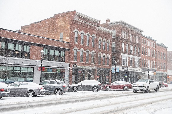
• Buffalo, New York, drivers face snowy commute: Lake-effect snow warnings are in effect in Buffalo until Thursday night. The surrounding area could see 1 to 3 feet of localized snowfall and wind gusts up to 40 mph. “Travel could be very difficult to impossible. The hazardous conditions could impact the morning or evening commutes,” the weather service warned.
• At least a dozen storm-related deaths: At least 12 deaths have been reported across Tennessee, Mississippi, Arkansas, Kansas and Oregon since January 12 amid almost unrelenting winter storms across the US. In Tennessee, where seven fatalities have been reported, a box truck driver was killed Monday evening when he lost control of the vehicle on a snowy Knoxville highway and careened into a tractor-trailer, police said.
Double whammy of ice and snow in Northwest
Back-to-back storms are delivering a “1-2 punch” to the Northwest with freezing rain and ice in Oregon and Washington and heavy snow through the region’s interior through the end of the week, the weather service said.
Winter storm warnings also extend over the Cascades and northern Rockies. Up to 3 feet of snow could fall over the Cascades through Thursday afternoon and up to 2 feet is possible in higher elevation areas in the northern parts of Washington, Idaho and Montana by late Thursday morning.
More than 3 million people in the region were under ice storm warnings early Wednesday, including hard-hit Portland, after a new storm moved onshore Tuesday night.
The highest ice amounts from the storm will be confined to elevated terrain. Up to an inch of ice could form in the South Washington Cascades and the surrounding foothills, where an ice storm warning is in effect until 10 a.m. Wednesday. Snowfall up to 7 inches and winds gusting up to 40 mph are also expected.
Arctic blast briefly backs off
After a brutal Arctic blast brought record-low temperatures and life-threatening wind chills across large portions of the US, temperatures will briefly moderate in most areas on Wednesday before another surge of cold air sets in, according to the weather service.
High temperatures will finally climb above zero degrees in much of the central US after the region endured dangerous sub-zero wind chills – a measurement of how cold the air feels on your skin – earlier this week.
As the worst of the cold eases off, the majority of wind chill warnings across the central and eastern US will expire throughout the day Wednesday. Still, wind chills as low as minus 25 degrees could be felt early in the day in cities in the Midwest, including Cincinnati, Detroit and Chicago.
A true warm-up is in store for southern Texas and eastward along the Gulf Coast, where highs will return to the 60s and 70s on Thursday.
Beginning Thursday, another Arctic blast is set to spread frigid, below-average temperatures across the northern Plains and Midwest and into the Deep South by the week’s end.
CNN Meteorologist Mary Gilbert and CNN’s Nouran Salahieh, Joe Sutton, Sarah Dewberry, Raja Razek and Jennifer Henderson contributed to this report.
The-CNN-Wire


