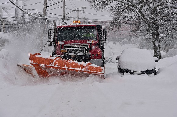
More snow hitting Great Lakes and Northeast, closing schools - hampering travel
CNN/Stylemagazine.com Newswire | 1/19/2024, 7:46 p.m.

Originally Published: 19 JAN 24 02:20 ET
Updated: 19 JAN 24 20:37 ET
By Aya Elamroussi, Sara Tonks, Paradise Afshar and Mary Gilbert, CNN
(CNN) — Another round of snow is covering the Northeast Friday, triggering emergency protocols in several areas as officials warn the conditions could make for dangerous travel through the evening.
More than 100 million people, nearly 30% of the US population, are under winter weather alerts across the Pacific Northwest, Northern Plains, mid-Atlantic and the Northeast. This comes on the heels of extreme winter conditions over the past week that have killed at least 64 people across 13 states, primarily in the Pacific Northwest and South. Five people in Kentucky have died due to the winter storms, the governor said in a news release.
Snowfall began across parts of the mid-Atlantic and Northeast early Friday morning after blanketing parts of the Midwest and Great Lakes late Thursday.
Snowfall totals of 1 to 3 inches were common by Friday afternoon from Nebraska and Iowa through Ohio and Pennsylvania. Higher amounts of 3 to 6 inches piled up in parts of eastern Kentucky and across the terrain of West Virginia.
Snow continued to fall across Washington, DC, Baltimore and Philadelphia Friday afternoon. Washington, DC, had already picked up more than 2 inches of snow Friday morning with measurements exceeding 3 inches in nearby Baltimore by late morning.
Philadelphia could see 4 to 6 inches of snow by the time the storm winds down late Friday. Parts of southeastern Pennsylvania and southern New Jersey had picked up between 2 and 4 inches by early Friday afternoon with totals expected to climb further.
Higher snowfall amounts developed south of New York City Friday, causing snow chances there to dwindle. New York City’s Central Park picked up 0.1 of an inch of snow by early Friday afternoon, while the city’s LaGuardia Airport recorded 0.6 of an inch.
New York City officials issued a travel advisory for Friday, warning of low visibility and possible travel delays.
Farther north, the lake-effect snow hammering the Buffalo, New York, area is expected to linger through the weekend. Buffalo could see an additional 3 inches pile on the heavy snow it has already received.
The heaviest lake-effect snow, up to 8 inches, could fall in the southern shores of the Great Lakes region, including Cleveland, Ohio, and Erie, Pennsylvania, into Saturday morning.
Emergency protocols activated across states
The forecast prompted officials to activate emergency protocols before snow began to fall.
A snow emergency is in effect Friday in Philadelphia, the city announced.
In New York City, emergency management officials have warned the Friday evening commute could be impacted by the storm.
As snow and cold temperatures blanket New York, outreach teams plan to canvass the city’s five boroughs to help provide shelter to those experiencing homelessness, the city said.
In nearby New Jersey, Gov. Phil Murphy extended the state of emergency as the state is expecting between 3 and 6 inches of snow.
“It appears that Mother Nature is making up for some lost time,” Murphy said Thursday evening. “After a couple of years with hardly any snowfall in New Jersey, today, we are headed for our second snowstorm of the week.”
Murphy warned the snow could melt into slush or turn to ice by Friday morning, making for a dangerous Friday evening commute.
A commercial vehicle ban was issued for multiple New Jersey highways early Friday morning. The order does not apply to the New Jersey Turnpike, Garden City Parkway and Atlantic City Expressway.
West Virginia is also under a state of emergency Friday.
On the West Coast, the entire state of Oregon is under a state of emergency due to the ongoing severe ice storm, the governor announced Thursday on social media.
“Thousands of people across the state have been impacted by the storm, including power outages, lack of transportation, and an array of safety concerns that come with severe weather,” Gov. Tina Kotek said in the statement.
“The state has been working with counties as they assess needs, including critical federal resources that can be unlocked by a statewide emergency,” Kotek said.
As of Friday evening, more than 79,000 homes and businesses in Oregon had no power, according to the tracking site PowerOutage.us.
Oregon and Washington state could see additional ice accumulation up to a half inch through Friday. Snowfall up to 6 inches is also possible, with the heaviest snow expected in high elevations and interior Washington through Friday.
Schools are shuttered
Some major school districts across the country have closed while others have opted for virtual learning or alternative dismissal times.
After several days of closures amid ice storms, Portland Public Schools in Oregon were shuttered again Friday. The district is one of the largest in the Pacific Northwest according to its website, with more than 49,000 students enrolled.
“As eager as we are to reopen schools, we will not make a decision that puts our community in danger,” Portland Public Schools said.
On the East Coast, Baltimore City Public Schools, The School District of Philadelphia, Fairfax County Public Schools in Virginia and Newark Public Schools in New Jersey are closed Friday. Passaic Public Schools in New Jersey will dismiss early.
But New York City Public Schools have proceeded with regular drop off and dismissal times Friday, the nation’s largest school district said. More than 1 million students attend NYC public schools.
In the Midwest, the Cleveland Metropolitan School District will be closed Friday, including the CMSD Virtual School and CMSD Remote School. Other Ohio school districts closed Friday include Akron Public Schools and Hamilton City Schools.
In Iowa, Stanton Community Schools and the Sidney Community School District opted for virtual learning Friday.
The-CNN-Wire


