Election Day storm could impact voter turnout in key midterm races in the central US
Meteorologist Chris Dolce, CNN | 10/29/2026, 11:43 a.m.
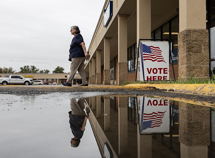
Early voting
Austin Johnson/AFP/Getty Images via CNN Newsource
A soggy storm will track through the central United States on Election Day and could influence voter turnout for key races in the region.
Confidence is growing for widespread rain from parts of the Great Lakes and Upper Midwest to the western Gulf Coast Tuesday, but exactly who gets the most disruptive soaking is still in question.
We’ll know more by this weekend, but for now, it’s looking like parts of Iowa, Kansas, Michigan, Texas, and maybe even Ohio, could contend with wet conditions.
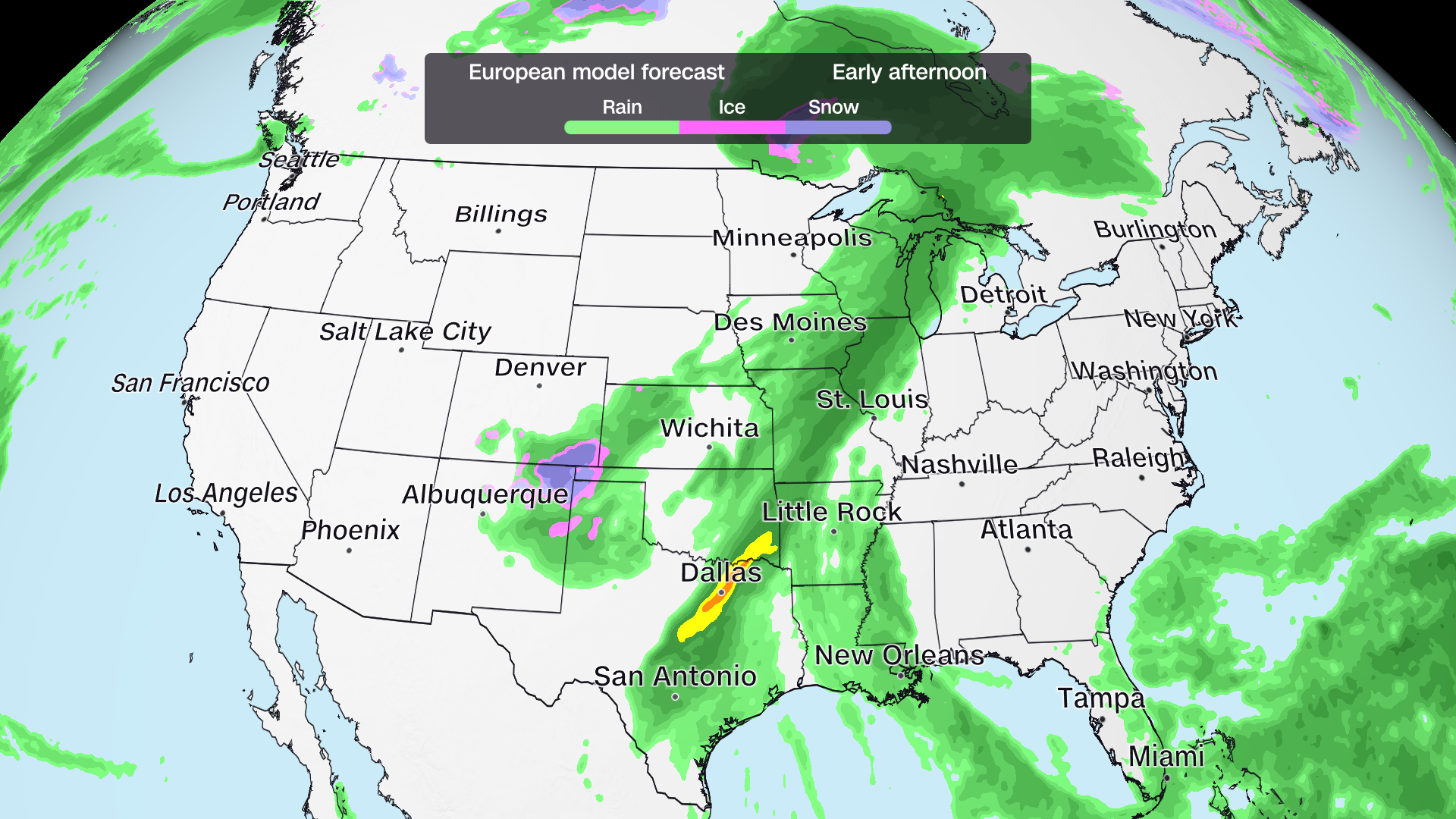
Gusty winds could also accompany the rain in the Midwest and Plains. Severe thunderstorms and heavy rain are possible threats on the storm’s southern side from Texas to the lower-Mississippi Valley.
The conditions will be a turnout factor in those states and for others in the central US who aren’t among the more than 39 million people who have already cast ballots through early voting.
Rainfall and other active weather tend to suppress voter turnout while sunshine has the opposite effect, multiple studies have found.
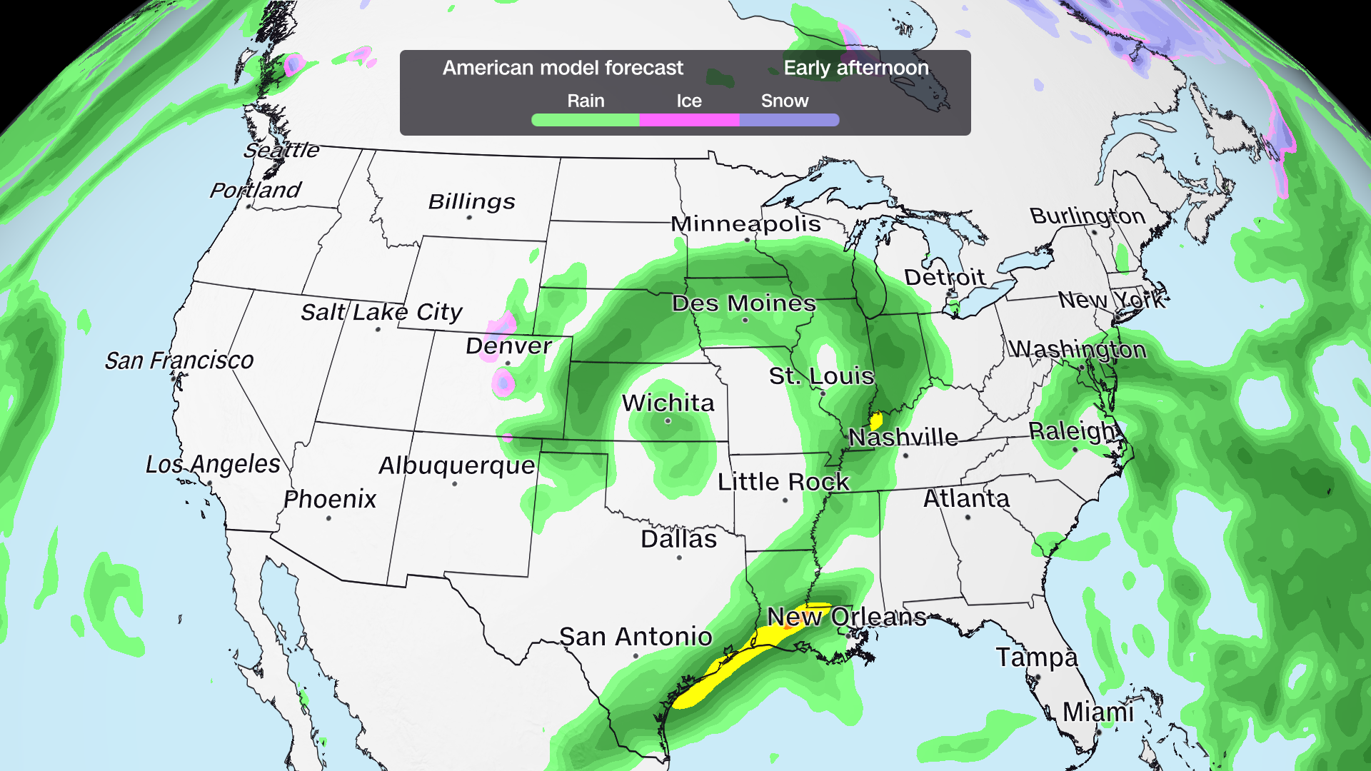
Dry weather will likely bookend the storm along much of the East Coast and in the West. The only exception is coastal areas of the Southeast where nuisance showers can’t be completely ruled out yet.
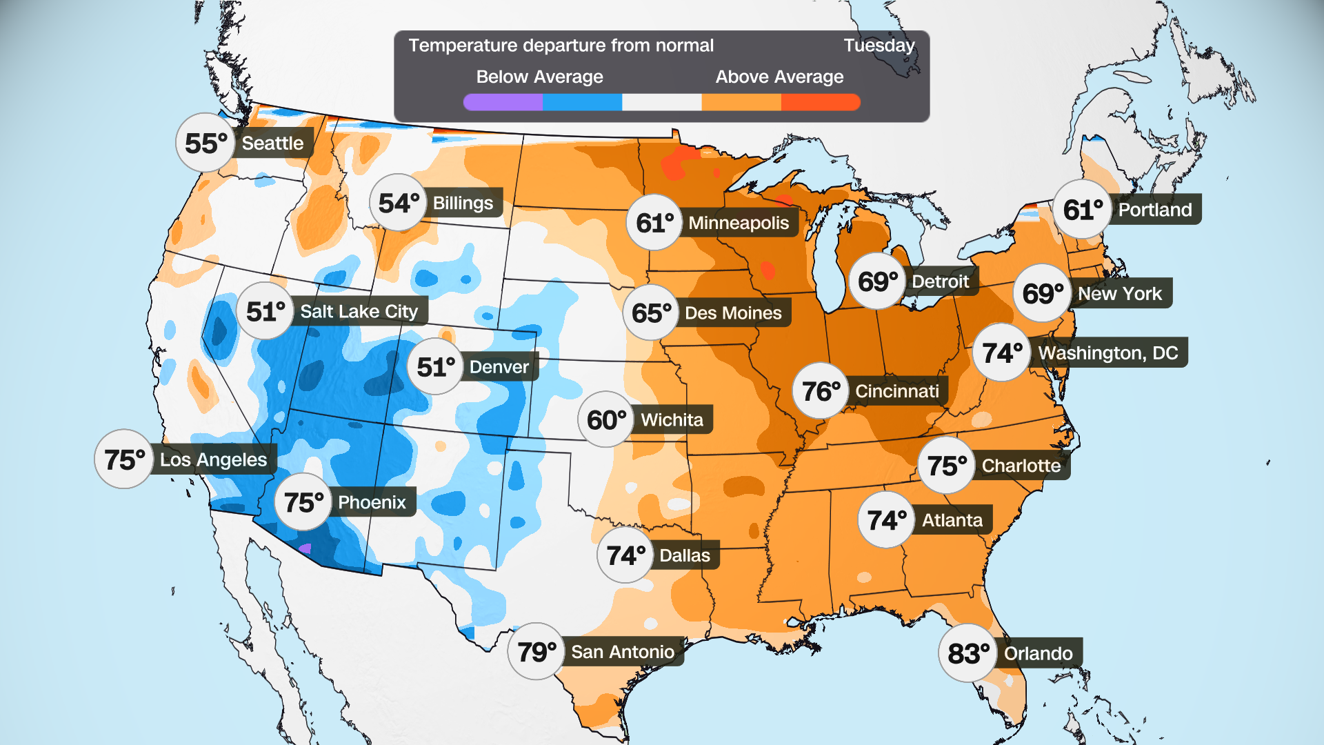
There will be no need to bundle up. High temperatures in most of the nation’s eastern half are forecast to be 5 to 15 degrees Fahrenheit above average. Only the Southwest will have temperatures tilting a bit cooler than average.
The breakdown below shows the forecast for some of the key states in the midterms. Keep in mind these forecasts will likely change as confidence grows in the storm’s path by this weekend.
Key race forecast
Georgia: Likely dry with highs in the 70s and low 80s.
Iowa: Rain is looking more likely than what models showed on Wednesday, but it’s still too early to pinpoint what parts of the state will be most affected. Highs are expected to reach the 50s and 60s.
Kansas: Rainfall is a good bet in parts of the state, but how much and exactly where is still up in the air. Highs will range from the 40s and 50s in the state’s northwest corner to the 60s in the east.
Maine: Likely dry with highs in the 40s and lower 50s.
Michigan: Much of the state could see showers for at least part of the day, but the timing is still in question. Highs will range from the 50s in the Upper Peninsula to the 60s in Lower Michigan.
New Hampshire: Likely dry with highs in the 40s and 50s.
North Carolina: Likely dry with highs in the 70s.
Ohio: Most forecast models keep rainfall west of the state, but it’s too early to rule out wet weather. Highs should reach the 60s and 70s.
Texas: The eastern half of Texas, especially along and east of Interstate 35, has the highest chance to see rain. Severe thunderstorms and heavy rainfall could be threats too. Highs will range from 80s near the coast to 60s in the state’s panhandle.