2024 H3AT Mapping Campaign: Uncovering Houston’s Hottest Neighborhoods and the Urban Heat Challenge
Francis Page Jr. | 2/25/2025, 10:49 a.m.
H3AT LOGO
The heat is on—literally. The 2024 Houston Harris Heat Action Team (H3AT) Mapping Campaign, the nation’s largest single-day, community-driven heat mapping initiative, has delivered eye-opening results. Conducted on August 10, 2024, the campaign enlisted over 150 dedicated volunteers to capture temperature and humidity data across 69 routes throughout Houston and Harris County.
The findings? A stark reality check on Houston’s urban heat island effect, offering critical insights into the city’s hottest neighborhoods and underscoring the urgent need for climate resilience strategies.
Scorching Data: How Heat Impacts Houston’s Communities
The campaign collected data during three key time periods—morning, afternoon, and evening—allowing researchers to track temperature variations throughout the day and compare daytime heating with overnight cooling patterns.
What they found confirmed what many Houston residents already know: not all heat is created equal.
- Green spaces and shaded neighborhoods remained noticeably cooler.
- Dense urban areas with high concrete concentration and minimal tree cover were disproportionately hotter.
- The most shocking revelation? A 14-degree difference between Houston’s coolest and hottest areas—a disparity that can mean the difference between mild discomfort and life-threatening heat stress.
“A 14-degree difference on a scorching Houston day could determine whether someone experiences discomfort or a dangerous health crisis,” says Dr. Stephanie Piper, a Community Development and Resilience Research Associate at HARC (Houston Advanced Research Center). “People who are already vulnerable—those without air conditioning, seniors, or residents in older buildings—face even greater health risks from extreme heat.”
For an in-depth look at neighborhood-specific temperature disparities, interactive heat maps and street-by-street temperature data are available at H3AT’s official website.
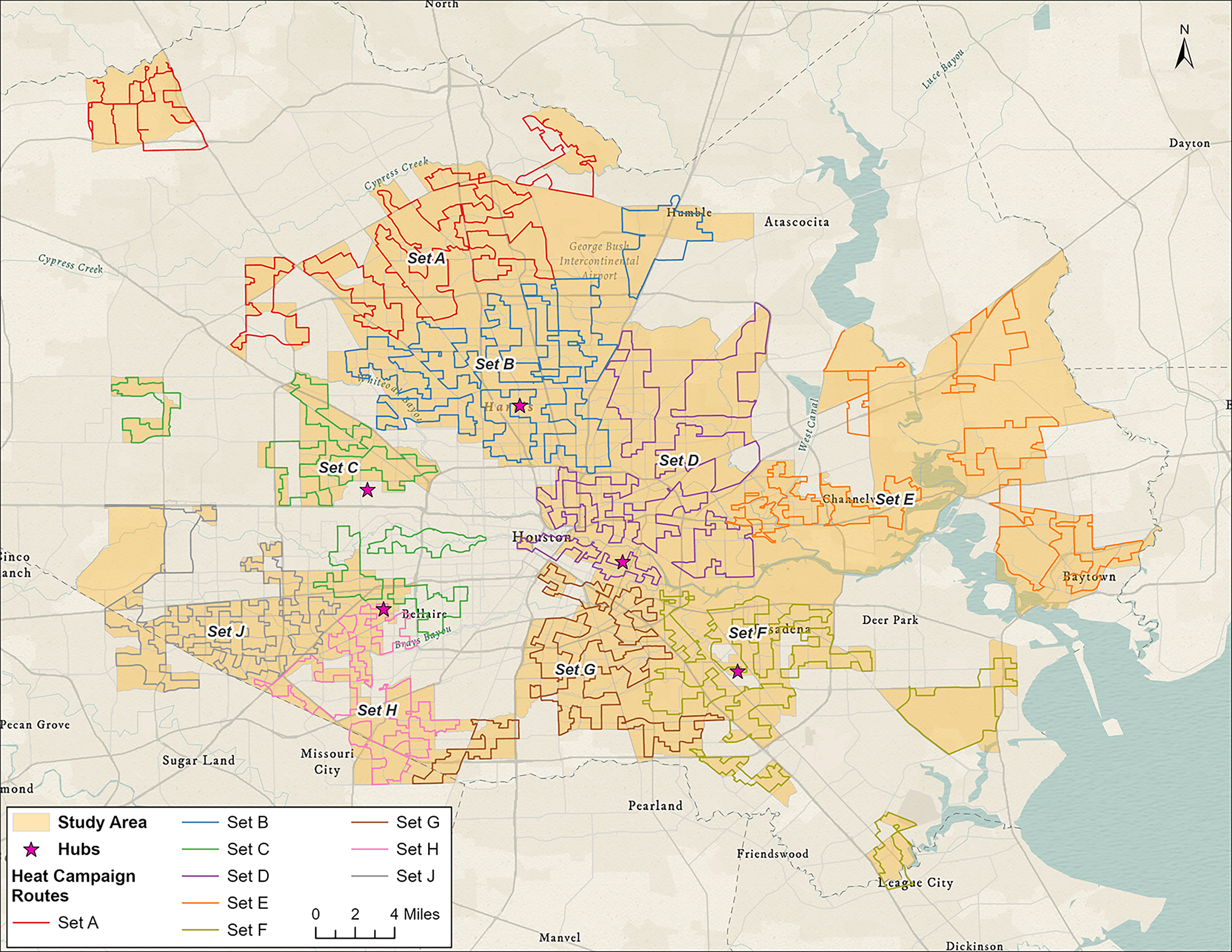 Heat Campaign Routes
Houston’s Urban Heat Island: A Growing Threat
The H3AT mapping campaign pinpointed severe heat zones in Houston, where temperatures soared well above the city’s average. These areas—often in historically underserved communities—face increased risks of:
✅ Heat-related illnesses (dehydration, heat stroke)
✅ Higher energy costs (due to extreme AC reliance)
✅ Environmental and health disparities (lack of tree cover, excessive concrete, limited green infrastructure)
“This data goes beyond just highlighting a problem,” Dr. Piper explains. “It helps prioritize cooling interventions in the neighborhoods that need it most.”
In response, city leaders, urban planners, and environmental groups will use this data to develop evidence-based solutions such as:
🌳 Tree-planting initiatives
🏡 Cool roofs and reflective pavements
🚏 Shaded bus stops and community cooling centers
🏙️ Sustainable urban planning improvements
A Community-Led Effort for Lasting Change
Houston’s heat mapping movement began in 2020, and this year’s campaign more than doubled its previous coverage area.
More than 150 volunteers drove 3,446 miles across Houston, covering Alief, Sunnyside, Fifth Ward, Pasadena, Greenspoint, and other heat-prone neighborhoods.
“The sheer number of volunteers eager to map their own communities speaks volumes,” says Piper. “Residents understand the severity of the heat problem, and they want real, data-driven solutions.”
This initiative was made possible through key funding from the Inflation Reduction Act and the USDA Forest Service’s Urban and Community Forestry Program, as part of ForUsTree: Creating an Inclusive Community Canopy—a groundbreaking program that enhances tree cover, resilience, and green job opportunities.
 2024 H3AT Mapping Project Team Organizers Logos
The Road Ahead: Cooling Houston’s Future
With H3AT’s 2024 mapping data now in the hands of researchers, policymakers, and environmental advocates, Houston has an unprecedented opportunity to create targeted heat relief solutions.
City planners will use the findings to expand cooling strategies, increase urban greenery, and ensure that every Houstonian—regardless of their zip code—can live, work, and thrive in a more heat-resilient environment.
Want to be part of the solution? Visit H3AT’s website to explore interactive maps and learn how you can support Houston’s climate resilience efforts.
About the Houston Harris Heat Action Team (H3AT)
H3AT is a collaborative effort spearheaded by HARC, in partnership with the City of Houston, Harris County Public Health, the National Weather Service, and other key stakeholders. Their mission: to assess and combat extreme heat’s impact on Houston through data-driven solutions, community engagement, and policy advocacy.
About HARC (Houston Advanced Research Center)
HARC is an independent, non-partisan research organization dedicated to sustainability solutions that improve the quality of life for generations to come. Learn more at www.harcresearch.org or follow them on Instagram, LinkedIn, Facebook, and Twitter.
Final Thoughts: Why This Matters for Houston
Houston is no stranger to record-breaking heat, but with community-led action, scientific innovation, and data-driven planning, the city can take meaningful steps toward climate resilience.
As Houston Style Magazine, we recognize that climate justice is social justice. The 2024 H3AT Mapping Campaign has revealed the challenges ahead—but it has also paved the way for powerful, equitable solutions.
Together, we can build a cooler, healthier Houston for all. 🌎🔥💙
#TeamStyleMag #HSM

