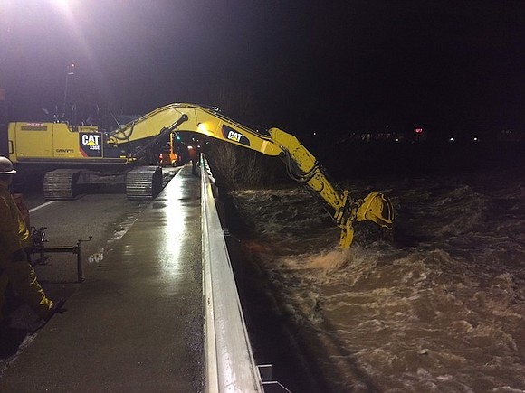
Another Storm Brings Snow and Rain to the West
CNN/Stylemagazine.com Newswire | 1/11/2017, 6:31 a.m.

By Madison Park and Holly Yan
CNN
SAN FRANCISCO (CNN) -- A succession of storms has been hammering the West Coast, triggering avalanches, mudslides and flooding -- and more weather warnings are in place Wednesday.
The recent spate of winter storms have brought several inches of rain and snow in parts of California.
"This is an unusual event," said Doug Carlson, spokesman for the California Department of Water Resources, about the recent rainfall. "We haven't had to do anything like this for 10 to 11 years."
"It's shaping up to be one of the five or so wettest wet seasons in California's record-keeping history," he said.
Although the rainfall is a welcome respite from the longstanding drought, recent conditions have created challenges. California, Nevada and other parts of the West are grappling with flooding and heavy snow.
The National Weather Service warned of the "life threatening snowfall with blizzard conditions" in the Sierra Nevada mountains. The blizzard warning in the greater Lake Tahoe area is in effect until 10 a.m. local time Wednesday. About five to 10 feet of snow has accumulated in the area, according to the agency.
A portion of the Interstate 80, the main east-west connector through northern California, has been shut as state workers try to clear an avalanche that fell across the eastbound portion of the road.
The risk of too much rain
Apart from the snow, flash flood warnings have been hoisted as more rain pelted parts of California Tuesday night. Flooding was expected to get worse overnight.
Parts of California have already seen more than 15 inches of rain over the past week, CNN meteorologist Haley Brink said.
Many Western rivers will continue to rise as rain that fell over the weekend keeps flowing down the Sierra Nevada into valleys and other low-lying areas. Another 5 to 10 inches of rain could fall throughout the next week in these already water-swollen areas, Brink said.
The sudden influx has knocked over trees that have weakened from years of drought, into cars, homes and streets.
In San Francisco, a downed tree limb landed on the tracks of BART, the area's subway system. This stranded commuters in the Bay Area for hours during Tuesday's evening rush hour.
Across the state line in Portland, a heavy snowstorm brought the evening commute to a crawl. It led to several schools to close across the city on Wednesday.
Bundle up, Midwest
Meanwhile, another round of arctic air will spread into the northern Rockies and northern Plains into Wednesday, the National Weather Service said.
Highs are expected to be 15 to 25 degrees below average, the weather service said.
And the Chicago area will get blasted with fierce winds, even by Windy City standards.
"Winds this strong could cause property damage & will make travel very hazardous for high profile vehicles," the National Weather Service's Chicago office tweeted.
And another quick round of rain and snow will fall in the Midwest on Wednesday, Brink said. But it won't last long because temperatures will rise this week from the Midwest to the East Coast.
Almost balmy in East
Many in the East will be able to shed their parkas by the end of this week.
"By Thursday, much of the eastern half of the US will see high temperatures at 15 to 25 degrees warmer than normal," Brink said.
"Above-average temperatures in the East are expected to persist through at least the middle of January."
CNN meteorologist Tom Sater, Taylor Ward and CNN's Joe Sterling, Samira Said and Jamiel Lynch contributed to this report.


